Route Guide: North Rim of the Grand Canyon
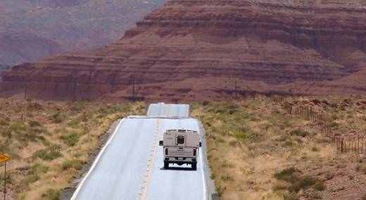
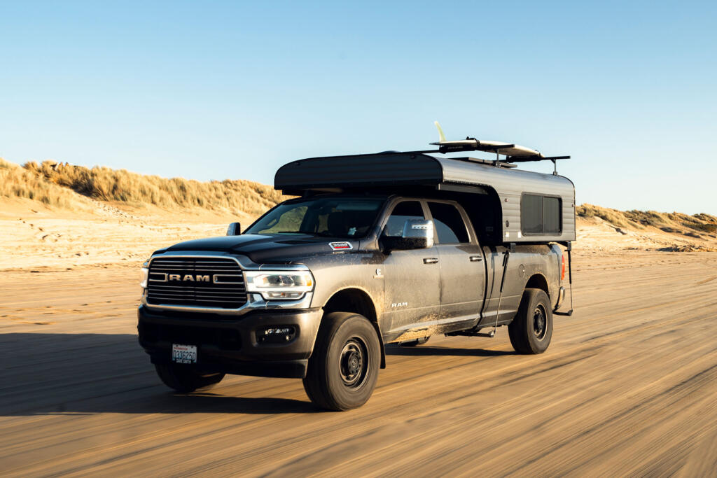
If you’re looking for a scenic highway with convenient gas stations and cell service, keep looking. The North Rim is a sprawling maze of dirt tracks, abandoned mining roads, and winding forest trails that’ll test both your rig and your patience. With 550 miles of rugged backcountry, this isn’t just a trip—it’s an exercise in self-reliance.
We’re not your GPS, and we won’t tell you which way to turn. Whether you’re chasing rock-crawling 4×4 trails, epic canyon overlooks, historic sites, or just a solid place to camp, we’ve rounded up our favorites—but how you piece them together? That’s your adventure. Skip what doesn’t interest you, linger where you want—just be prepared. With 400+ miles between fuel stops and unpredictable road conditions, this trip rewards the well-equipped and punishes the unprepared.
(Okay, we admit this isn’t really a ‘route guide’—more like a survival test disguised as a road trip. We kicked off this series with Beartooth Highway, where the pavement made life easy. This time? The only wrong move is thinking “remote” just means spotty cell service.)
Why Visit the North Rim?
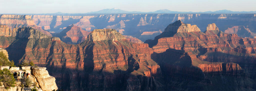
The Grand Canyon’s North Rim may be only 20 miles from the South Rim as the crow flies, but it feels like an entirely different world.
Here’s what sets it apart:
- Far Fewer Crowds – The North Rim sees only 10% of the visitors that the South Rim does, making for a more peaceful, immersive experience.
- Higher Elevation & Unique Landscape – Sitting at 8,000+ feet, the North Rim features towering pines, golden aspen groves, and open meadows, unlike the arid, rocky terrain of the South Rim.
- Seasonal Access – Due to heavy snowfall, the North Rim is only open from May 15 to October 15 (with limited access in November).
What You Need to Know Before You Go
Best Time to Visit
- Spring & Fall – April-May and September-October are ideal for cooler temperatures and fewer crowds.
- Summer – Expect scorching heat, especially in the lower elevations.
- Winter – Heavy snowfall can block access to key roads. The road to Kelly Point closes seasonally, so always check conditions before heading out.
Road & Trail Conditions
Most of the route consists of well-maintained dirt and gravel roads, but some sections require high-clearance 4x4s.
- Fuel – There’s 400+ miles between gas stations, so top off in Fredonia before heading into the backcountry.
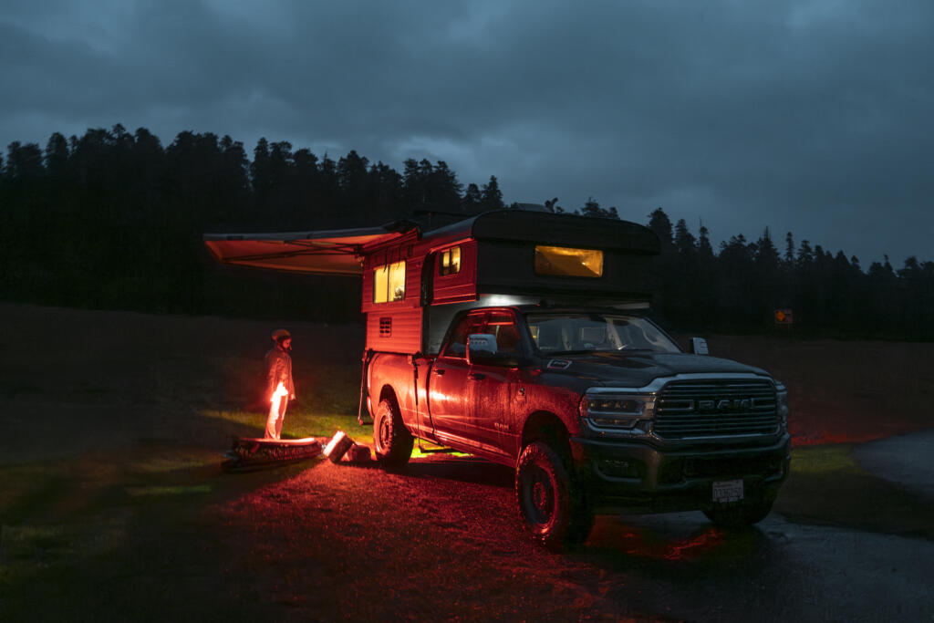
- Camping – Dispersed camping is widely available, but a permit is required for backcountry camping in Grand Canyon National Park.
- Essential Gear – Full-sized spare, extra fuel, a winch, and a chainsaw (deadfall is common).
Must-See Destinations
This is where we set you loose. We’re not here to tell you how to travel—just to point out the good stuff so you can decide what fits your style. Want epic canyon overlooks? Got ‘em. Prefer ghost towns and petroglyphs? You’re covered. Just looking for a quiet campsite where you won’t see another soul? Plenty of those too. Take what you need, skip what you don’t, and make this trip your own.
North Rim Visitor Center
📍 Start Here | Best for: Orientation, permits, and a first taste of the Grand Canyon’s vastness
Start here. Stretch your legs, grab maps, check road conditions, and ask a ranger if your plan is completely ridiculous or just slightly ambitious. Once you’ve got the info you need, take a minute to soak in your first epic canyon view at Bright Angel Point before heading into the wild.
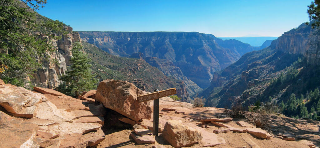
Coconino Overlook
📍 Short Hike Required | Best for: A jaw-dropping introduction to Bright Angel Canyon
Just 0.7 miles from the North Kaibab Trailhead, this overlook rewards hikers with an unobstructed view of Bright Angel Canyon. The steep but short hike down offers a taste of the terrain that makes the North Rim special—towering cliffs, scattered pines, and an endless drop into the canyon below.
💡 Tip: Sunrise or sunset light enhances the red and orange hues of the rock formations, making this a perfect photo stop.
Point Sublime
📍 Rough 4×4 Trail | Best for: Extreme solitude and panoramic canyon views
This one makes you earn it. A brutal 17-mile off-road stretch (requiring a high-clearance 4×4 and some patience) leads to one of the most jaw-dropping, remote overlooks in the Grand Canyon. No railings, no crowds—just 270 degrees of sheer canyon glory.
💡 Tip: Bring plenty of water and supplies—this is true wilderness, and there are no services nearby.
Kanabownits Lookout
📍 Former Fire Lookout | Best for: Overlooking the Kaibab Plateau
Once a fire lookout station, Kanabownits Lookout provides a stunning view of the Kaibab Plateau and surrounding wilderness. This stop sits at 8,500 feet, offering a chance to take in sweeping pine forests, high-country meadows, and the occasional grazing bison or elk.
💡 Tip: The road leading to Kanabownits can be rough after rain—check conditions before making the detour.
Jumpup Cabin & Jumpup Point
📍 Historic Stop | Best for: Exploring an old ranger cabin and a remote canyon overlook
A hidden piece of history, Jumpup Cabin was once used by rangers and early explorers of the North Rim. The surrounding landscape offers classic Arizona backcountry views—rugged, sunbaked cliffs and sparse desert vegetation.
From here, drive or hike a short distance to Jumpup Point, where the canyon suddenly opens into a vast expanse of red rock formations stretching toward the horizon.
💡 Tip: Keep an eye out for bighorn sheep, which are known to navigate the steep cliffs in this area.
SB Point
📍 Remote & Isolated | Best for: Seeing the canyon from one of its least-visited overlooks
If you’re looking for true solitude, SB Point delivers. This rarely-visited overlook offers an uninterrupted view of the Grand Canyon’s vast northern wilderness, with no buildings, railings, or other people in sight.
💡 Tip: The road to SB Point is rough, and a 4×4 with good clearance is required.
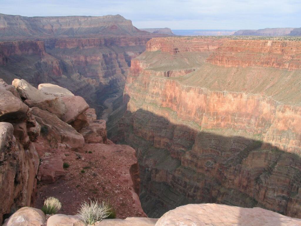
Toroweap (Tuweep) Overlook
📍 3,000-foot sheer drop | Best for: One of the most dramatic views of the Colorado River
Toroweap doesn’t mess around. This 3,000-foot sheer drop to the Colorado River has zero railings, zero fences, and zero room for error. It’s raw, it’s wild, and it’ll test your stomach.
💡 Tip: The road to Toroweap is long and rough, and trailers are prohibited. Check weather conditions before heading out, as rain can make the dirt roads impassable.
Nampaweap Petroglyphs
📍 Ancient Rock Art | Best for: History buffs and archaeology lovers
This site features hundreds of intricate petroglyphs carved into volcanic rock by Ancestral Puebloan people over 1,000 years ago. The petroglyphs depict wildlife, human figures, and geometric patterns, offering a glimpse into the cultural history of the region.
💡 Tip: The petroglyphs are easily accessible via a short, flat hike from the parking area.
Mt. Trumbull
📍 Prominent Peak in the Arizona Strip | Best for: Expansive views of the Grand Canyon’s northern wilderness
Mt. Trumbull is one of the highest points in the Arizona Strip, offering a commanding view of the surrounding desert landscape. The hike to the summit is challenging but rewards adventurers with an incredible 360-degree vista stretching for miles.
💡 Tip: Spring and fall offer the best conditions for hiking—summer temperatures can be brutal.
Bar 10 Ranch
📍 Remote Ranch & Lodge | Best for: A warm meal and overnight stay
This working cattle ranch has become a well-known stop for overlanders and Grand Canyon adventurers. Bar 10 Ranch offers lodging, meals, and even scenic flights over the canyon. It’s a great place to refuel (both literally and figuratively) before heading deeper into the backcountry.
💡 Tip: Reservations are required for overnight stays or meals.
Whitmore Point
📍 Hike to the Colorado River | Best for: A rare chance to touch the water
Whitmore Point is one of the few places where you can hike down to the Colorado River from the North Rim. The trail descends into the canyon, providing incredible views of the river cutting through the rock.
💡 Tip: This is a challenging hike with little shade—bring plenty of water.
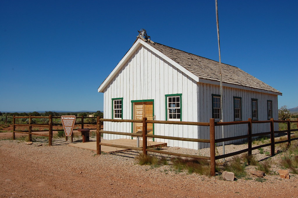
Mt. Trumbull Historic Schoolhouse
📍 Pioneer-Era Schoolhouse | Best for: A glimpse into the past
This beautifully restored 19th-century schoolhouse once served early settlers of the Arizona Strip. Inside, you’ll find historic photos, artifacts, and exhibits that tell the story of pioneer life in this rugged region.
💡 Tip: The schoolhouse is located on a scenic backroad—perfect for a mid-day stop and picnic.
Kelly Point Overlook
📍 One of the hardest-to-reach overlooks | Best for: Seclusion and breathtaking views
Kelly Point is a serious off-road challenge, requiring advanced 4×4 skills to reach. However, those who make the journey are rewarded with one of the most secluded and awe-inspiring views of the Grand Canyon.
💡 Tip: Road conditions vary wildly—check before attempting the drive.
Twin Point Overlook
📍 Epic Sunset Spot | Best for: Jaw-dropping evening views
Twin Point is a hidden gem known for its phenomenal sunset views. The overlook provides an unobstructed view of the canyon’s western horizon, where the rock formations glow red and orange in the fading light.
💡 Tip: Arrive at least 30 minutes before sunset for the best experience.
Grand Gulch Mine
📍 Abandoned Mining District | Best for: History and exploration
This historic mining site features old buildings, equipment, and mine shafts from Arizona’s early silver and copper rush. It’s a great stop for those who love desert ghost towns and history.
💡 Tip: Some structures are unstable—explore with caution.
Quick FAQs
How difficult is the North Rim Grand Traverse?
It’s not for your Subaru Crosstrek. Most of the route is doable, but some sections will make you question your life choices. A high-clearance 4×4 is your friend.
Do I need a permit?
Yes—if you’re planning to camp inside Grand Canyon National Park, you’ll need a permit (because rules). But if you’re just out wandering the Kaibab or Parashant backcountry? No permits, no problem.
What’s the closest town for supplies?
Fredonia, AZ, is your last stop for fuel, food, and repairs.
Is there cell service?
No. Bring a satellite communicator or GPS device.
Final Stop—For Now
That’s it—you’re on your own. No turn-by-turn directions, no rigid itinerary—just a list of legendary backcountry stops and the freedom to make this trip your own. Whether you hit every overlook or veer off course to chase the sunset, the North Rim rewards those who embrace the unexpected.
Just remember: fuel up, check conditions, and don’t underestimate these roads—this isn’t the place for half-baked plans or bald tires. Next up? We’re heading to the Cascade Loop in Washington, where the roads are paved, the signs actually tell you where to go, and we might—just maybe—offer something closer to a real route guide as opposed to this wild west approach. No promises, though.